Thales Alenia Space teams will be on the Thales stand at the Seoul International Aerospace and Defense Exhibition (Seoul ADEX) from October 17 to 20 at Seoul Airport to showcase our latest defense communications, radar remote sensing and satellite navigation technologies. Our Stratobus stratospheric airship will also be in the spotlight.
Space for security and defense

Space is increasingly vital for defense, especially military communications, space intelligence, navigation and security.
Milsatcom
Military communications satellites are set to become increasingly interconnected, operating from different orbits across resilient and diverse networks. At any given moment, armed forces will be able to combine the global coverage and low latency of low-Earth, medium-Earth and polar constellations with the power and resilience of geostationary satellites like the Italian Sicral 3 and French Syracuse IV systems, affording the mobility, performance and dependability required to conduct high-intensity operations.
Space intelligence

Korea 425 project © Thales Alenia Space
Our space systems supply high-precision imagery to many nations through our range of high- and very-high-resolution optical and radar instruments, unrivaled in Europe. The return of high-intensity conflicts calls for different doctrines concerning space-based Earth-observation assets, like the combination of very-high-performance optical and radar systems. Intelligence services will also be able to rely on new technologies like high-revisit-rate optical and/or radar constellations.
In 2018, Thales Alenia Space was selected by South Korea to build an Earth-observation constellation of four synthetic aperture radar (SAR) satellites. The Korea 425 project will be operated by the country’s government to conduct surveillance, gather intelligence and monitor specific areas of interest using high-resolution imagery. A key advantage of radar technology is day/night, all-weather acquisition, thanks to its ability to “see” through clouds.
Positioning and navigation
Galileo: already four billion users around the world

Galileo Second Generation © Thales Alenia Space
Satellite navigation systems like Galileo fulfill a precise positioning and timing mission. Galileo supports Europe’s satnav sovereignty and today boasts more than four billion users around the world.
Thales Alenia Space was involved in all phases of first-generation Galileo system development, with responsibility for system support, the mission ground segment and the Galileo Security Facility (GSF). In 2021, we were selected by the European Space Agency (ESA), on behalf of the European Commission, to build six of the twelve new satellites for the Galileo Second Generation constellation. In July this year, Thales Alenia Space signed contracts with ESA and the Commission to design and build, with its European partners, the Galileo Second Generation mission ground segment and to provide systems engineering support. Our teams are also working on a new low-Earth-orbit navigation system concept (LEO PNT) designed to make Galileo signals more robust.
EGNOS and Safety of Life services

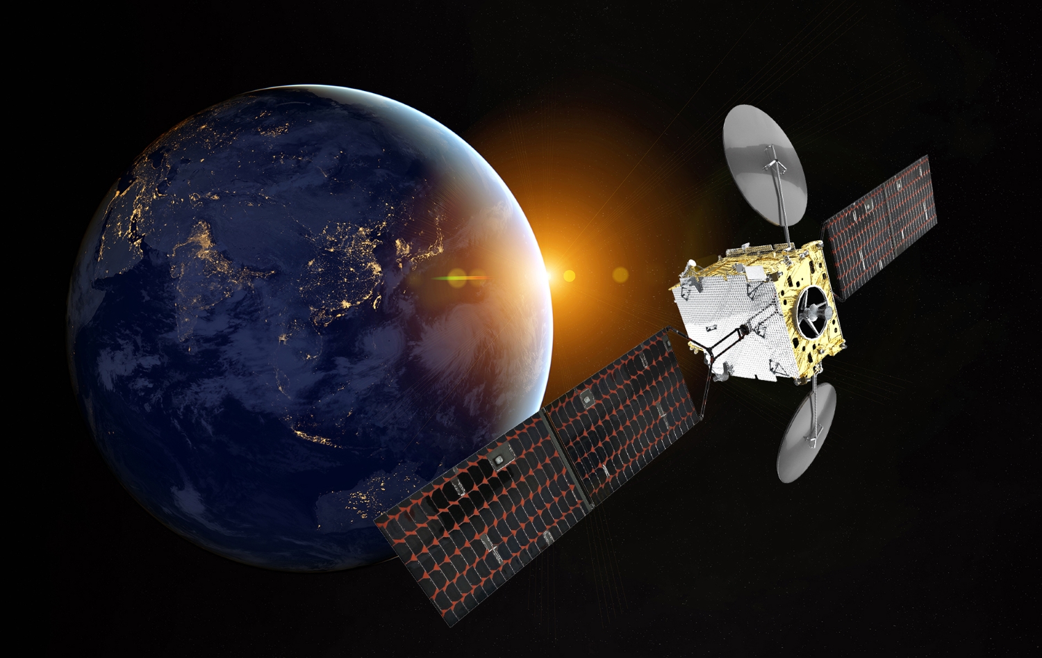
KOREASAT 6A © Thales Alenia Space
EGNOS (European Geostationary Navigation Overlay Service) augments Galileo’s performance and precision across Europe. It is used to land aircraft at small airports and for maritime transportation, typically for operations like navigating narrow channels, for example. Thales Alenia Space has continuously improved the land-based segment to deliver the integrity vital for the ultra-precise and reliable positioning required by new applications such as autonomous road, rail and maritime operations. Safety of Life services are already being provided for aviation.
KASS (Korea Augmentation Satellite System), developed jointly since 2016 by Thales Alenia Space and the Korea Aerospace Research Institute (KARI), is similar to EGNOS. It augments and enhances the positioning and navigation performance of global navigation satellite systems (GNSS) for many sectors, especially aviation. Designed to the standards of the International Civil Aviation Organization (ICAO), it aims to increase the precision and reliability of GPS signals to make flying safer and more efficient, while also reducing its environmental footprint.
In 2022, we were selected as prime contractor for the KOREASAT 6A satellite by KT SAT Corporation Ltd (KT SAT), the satellite communications operator of South Korea. In April this year, KT SAT and Thales Alenia Space announced that the satellite would also be carrying a Satellite-Based Augmentation System (SBAS) payload to enhance the continuity and operational availability of KASS.
Stratobus: midway between a satellite and a drone

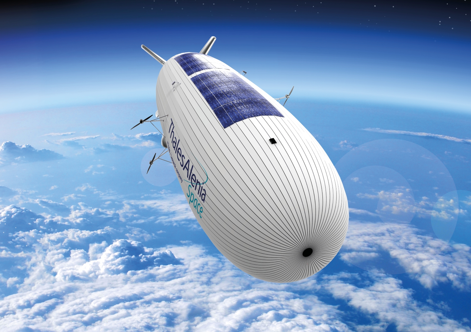
Stratobus © Thales Alenia Space
Thales Alenia Space is the prime contractor for a truly innovative system called Stratobus. Ideally complementing conventional satellites, this autonomous multi-mission stratospheric platform is in a way the missing link between the drone and the satellite. Designed for regional missions, the airship flies at an altitude of 20 kilometers, above jet streams and air traffic. It is aimed at regional civil and military communications, navigation and observation applications.
The solar-powered Stratobus will be capable of staying aloft for one year, operating above land, sea, deserts, mountains and rainforests, while avoiding the need for local ground infrastructures. It features numerous state-of-the-art technologies, including a high-strength envelope, lightweight solar panels and batteries, and its own dedicated flight management system.
Stratobus is a ground-breaking technology that does not require a launcher. It will serve armed forces and emergency management agencies, offering a continuous regional presence. As the ideal complement to the Copernicus space-based monitoring program, Stratobus will also support environmental surveillance applications, notably pollution monitoring and wildfire detection.
Visit us on the Thales stand (E507) at Seoul Airport.


