On Earth Day, all eyes are on the climate emergency confronting us. The findings of the Sixth IPCC Report provide clear warning that global warming is accelerating, extreme weather events are getting more frequent, and ecosystems and biodiversity essential to humanity are declining.
Consequently, a close understanding of climate mechanisms is crucial to inform effective and sustainable policies, and for that we need the reliable and precise tools that the space sector constantly strives to offer.
Earth-observation satellites designed, developed and operated by Thales Alenia Space are key to meeting environmental challenges. They are supplying a wealth of precise and regularly refreshed environmental data on air quality, wave height, sea level rise, ice melt, deforestation, natural resource management, and natural disaster monitoring and preparedness to protect populations around the world.
This data obtained by space technologies is helping us not only to keep our finger on the pulse of the planet, but also to anticipate and model the impacts of climate change, and thereby to craft adaptation and mitigation strategies.
On this year’s Earth Day, we wanted to turn the spotlight on solutions conceived by Thales Alenia Space that are helping to monitor the environment and preserve the planet, with a view to working together to build a more resilient future and safeguard our common home.
2026 is a shaping up to be a great year for our teams, who are proud to be working through a wealth of projects to preserve our beautiful planet.
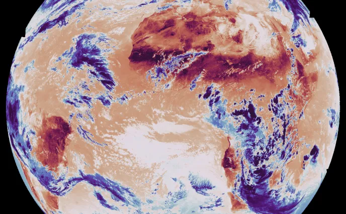
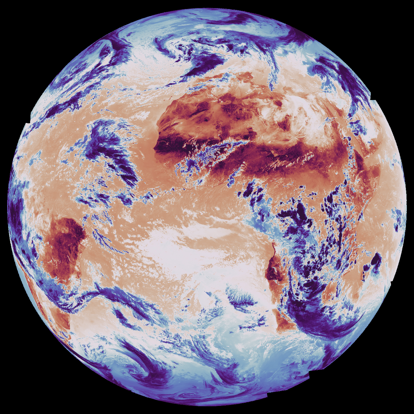
Copernicus: The gold standard in environmental monitoring

Copernicus is the most ambitious program ever dedicated to monitoring the environment, composed of 12 families of satellites surveying Earth, its topography, seas, lakes, oceans and polar regions. Copernicus also encompasses climatology missions and programs measuring human-induced CO2 emissions or affording new applications to foster sustainable agriculture and biodiversity. A program of this scale is key to enabling Europe to better anticipate the consequences of global warming and safeguard our planet.
Keeping an Eye on the Earth
Developed on behalf of the European Space Agency (ESA) for the European Commission’s Copernicus program, the Sentinel series of satellites is in the vanguard of Europe’s environmental monitoring efforts. Sentinel-1 surveys land and sea surfaces in all weather conditions, day and night, thanks to its radar capabilities. Sentinel-2 and -3 acquire high-resolution optical imagery over land and coastal waters. Sentinel-4 and -5 are dedicated to meteorology and climatology. And Sentinel-6 surveys the world’s oceans. Thales Alenia Space is prime contractor for the Sentinel-1 and Sentinel-3 series of satellites — four for each mission. We are also contributing to the imaging spectrometer on Sentinel-5P and supplying the Poseidon-4 radar altimeter for Sentinel-6.
Thales Alenia Space also has been chosen for five of the six new Copernicus Expansion missions, as prime for three of these missions (CIMR, ROSE-L and CHIME), and payload supplier for two more (CO2M and CRISTAL). These new satellites will measure human-induced atmospheric carbon dioxide, survey sea ice and snow cover, support new optimized services for sustainable farming and biodiversity, observe sea-surface temperature and salinity, as well as sea ice density, and strengthen land monitoring and emergency management services.
Our company is contributing to 11 of the 12 Copernicus missions, working hand in hand with ESA and the broader European space industry.
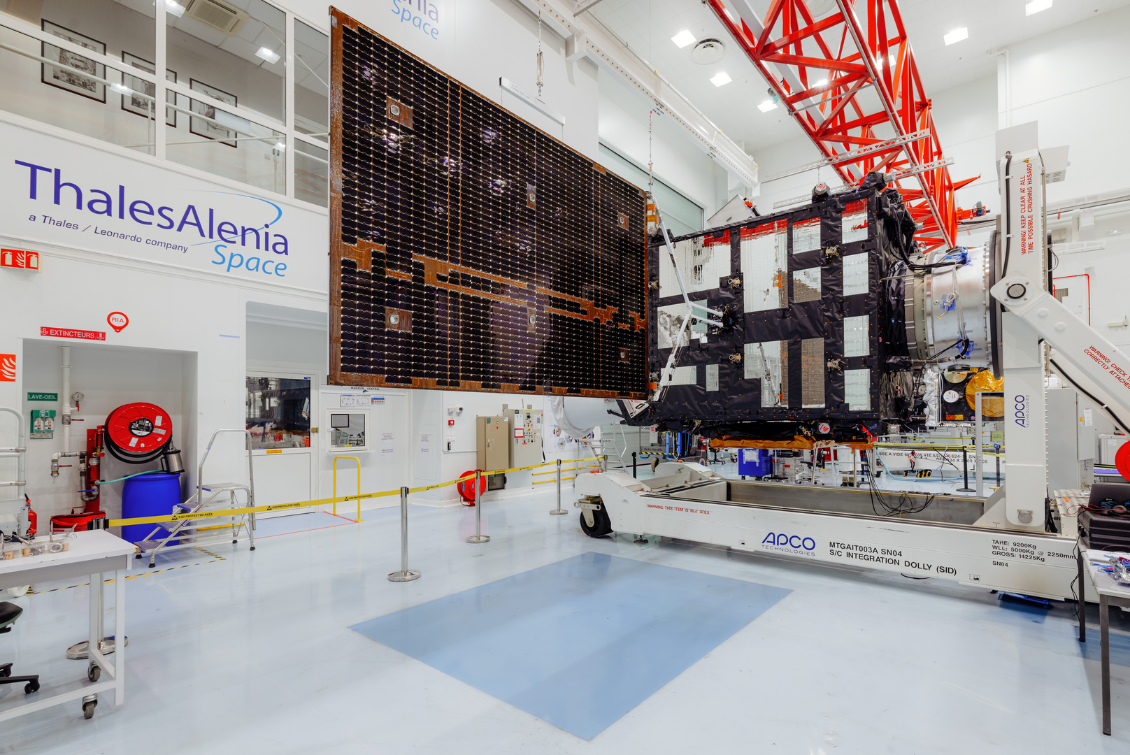
Sentinel-3C in orbit by the end of this year
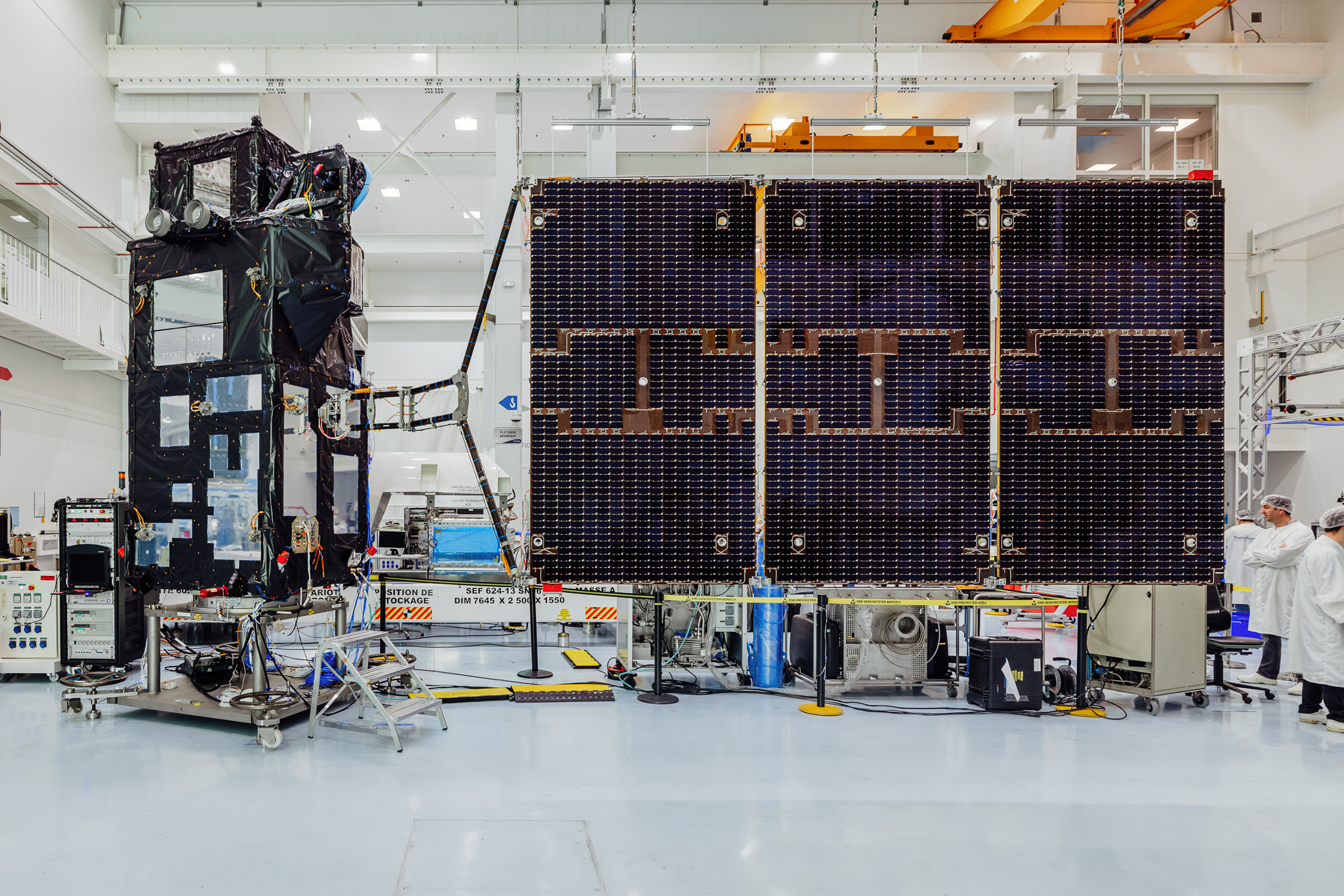
The latest satellite in the series, Sentinel-3C, will be launched this year to ensure mission continuity. Dedicated to operational oceanography and land monitoring, the satellite will be carrying a suite of sophisticated instruments, notably to measure ocean temperature, wave height, ocean color and land surfaces, delivering vital data to gain deeper insights into Earth’s climate, to survey its oceans, and to manage its natural resources effectively.
FLEX: A new vision from space to monitor plant and ecosystem health
The FLEX program (FLuorescence EXplorer) initiated by ESA aims to measure plant fluorescence from space, covering vast territories to gain new insights into plant health and productivity on a global scale.
The FLEX satellite will be carrying FLORIS (FLuORescence Imaging Spectrometer), an instrument designed to generate global maps of plant fluorescence and quantify how photosynthetic activity is affected by the stress to which they are subjected. The satellite will have the ability to detect plant vitality and stress well before they become apparent to the naked eye.
Data collected by FLEX will deepen our understanding of how carbon moves between plants and the atmosphere, and how photosynthesis affects the carbon and water cycles. It will also enable us to identify and characterize the effects of different types of stress on plant fluorescence and photosynthesis.
With global warming and extreme weather events becoming ever more intense, the FLEX mission will help us to gage how climate change is impacting photosynthesis and therefore plant health and productivity — vital to manage resources effectively in the future and preserve biodiversity.
FLEX will be dual-manifested this year with Sentinel-3C and placed into an 814-kilometer orbit, where it will operate in tandem with the Copernicus program’s Sentinel-3 satellite. The synergies between FLEX and the Sentinel-3 mission constitute a giant leap forward for global monitoring of vegetation, combining FLEX’s high spectral resolution with Sentinel-3’s revisit cycle to better interpret the plant fluorescence signal and its associated variables.
By providing a new vision of how Earth’s ecosystems work, FLEX is helping to preserve our environment and support sustainable practices for the future.
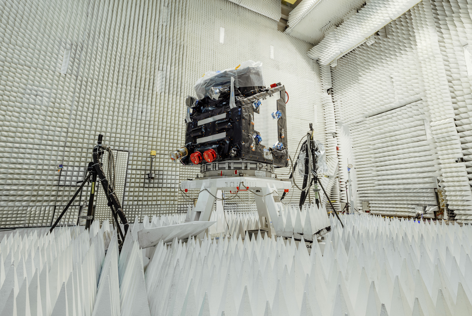
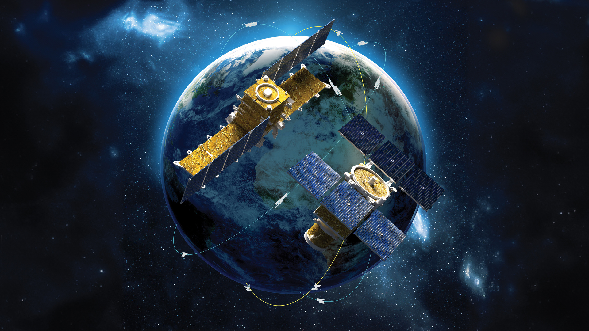
MTG: Geostationary weather satellites enter a new era
As extreme weather events get more and more intense, the reliability and accuracy of weather forecasts have never been more crucial. With this aim in mind, Europe is deploying Meteosat Third Generation (MTG), a state-of-the-art space program signaling a revolution in weather and climate monitoring. Thales Alenia Space is prime contractor for MTG, which comprises six satellites — four imaging and two atmospheric sounding satellites — and is set to revolutionize meteorology by improving forecasting accuracy. The imaging satellites are being built by us, and the atmospheric sounding satellites by our partner OHB. Increasingly frequent extreme events driven by climate change are threatening populations and ecosystems. Thanks to its faster and more precise observations, MTG will enable us to give early warning to populations and inform decision-makers, and to anticipate the impacts of violent thunderstorms, windstorms and heatwaves.
MTG is a joint program of ESA and Eumetsat (European Meteorological Satellite organization) designed to ensure high-resolution meteorological monitoring out to 2040 and beyond.
MTG satellites operate in geostationary orbit 36,000 kilometers above the Earth. The first two in the series — the imaging satellite MTG-I1 and the atmospheric sounding satellite MTG-S1— were launched in December 2022 and July 2025.
The imaging satellites carry a Lightning Imager (LI) capable of acquiring imagery of Earth every 10 minutes (2 minutes 30 seconds over Europe), while the atmospheric sounding satellites map the planet’s atmosphere in 3D to provide an unprecedented picture of weather systems. These sounders will allow us to detect extreme weather events a full half-day earlier than before. And by combining data from all of the system’s instruments, meteorologists will be able to forecast weather out to eight days — a giant leap forward in giving populations early weather alerts.
The second imaging satellite (MTG-I2) will be launched this summer to complete the first MTG constellation.
MTG-I2 will notably deliver weather images every 2 minutes and 30 seconds over Europe, whereas the first imaging satellite is configured to obtain images of Earth’s disk every 10 minutes. Such detailed imagery of the atmosphere enables closer monitoring of weather events like windstorms, thunderstorms and cyclones. The MTG satellites’ sophisticated instruments are helping to refine weather forecasts, supporting civil protection teams, and giving earlier warning of extreme weather events. MTG will help to save lives and pave the way for new types of services for citizens in Europe and Africa. Once the full fleet of MTG satellites is in orbit, Europe will have the most sophisticated weather forecasting services in the world.
IRIDE constellation serving Earth
Supported by Italy’s National Recovery and Resilience Plan (PNRR) and led by ESA in partnership with the Italian space agency ASI, IRIDE is a constellation of mainly radar but also optical microsatellites offering unrivaled prospects for monitoring Earth’s environment and managing its resources sustainably.
Employing various instruments and remote-sensing technologies, this constellation will cover a broad spectrum with radar — notably synthetic aperture radar (SAR) — and optical sensors, at high and medium resolutions and in various frequency ranges, from panchromatic to multispectral, hyperspectral and infrared bands. Thales Alenia Space will build 12 SAR satellites and an optical satellite, based on the NIMBUS (New Italian Micro Bus) modular spacecraft bus designed with high-revisit, high-capacity constellations in mind.
In addition to providing services to the Italian government, IRIDE will also support civil protection services and other government agencies in fighting hydrogeological instability and wildfires, protecting coastlines and monitoring critical infrastructures, and measuring air quality and weather conditions. The system will also provide data analytics for the development of commercial applications by startups, small and medium-sized enterprises and diverse sectors of industry.
Every day, Earth-observation satellites and their optical and radar instruments are watching over our planet from orbit.
Satellite data documenting our planet’s health and climate is helping scientists and policymakers to better understand the impacts of climate change, to optimize use of natural resources, to protect populations at risk, and to evaluate and adjust environmental policies.
Stay tuned for the latest news on Earth-observation satellites!