Every year, Earth Day reminds us how precious our planet is — and how fragile.
The findings of the IPCC’s sixth report are conclusive: climate upheaval is accelerating, extreme weather events are more frequent, and now more than ever, coordinated global action is needed to limit the damage. From heatwaves to storms, melting ice to rising sea levels, Earth is under pressure like never before. According to the report, global temperatures are already up 1.1°C from preindustrial times, leading to an increase in extreme climate events.
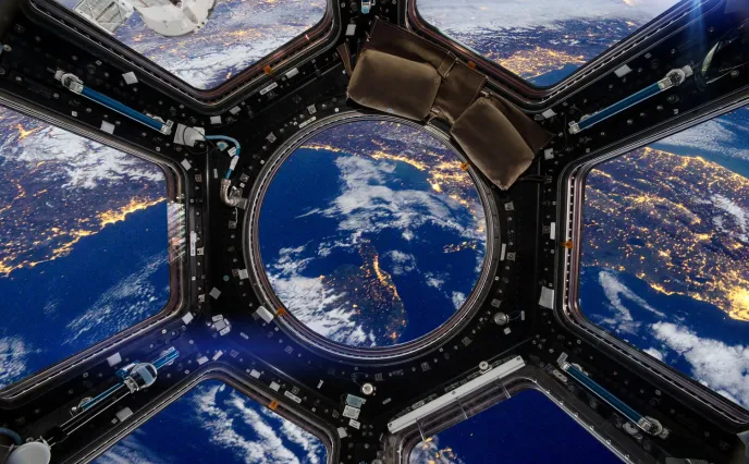
To act effectively, we must first understand the climate phenomena governing these events. And that’s where space comes in. Space technologies give us the all-important tools to help protect our planet. Real-time Earth observation lets us analyze the transformations taking place, so we can proactively address the challenges ahead. From their vantage point in space, satellites track the impact of human activities on our evolving ecosystems, giving us the global picture we need to predict climate change and protect future generations.
Here at Thales Alenia Space, our teams are proud to be part of a whole host of environmental monitoring programs. Each of these programs is playing a crucially important role in safeguarding and preserving our planet. Here are just a few examples.
Copernicus in the vanguard of environmental monitoring

Copernicus © Thales Alenia Space
Copernicus is the world’s most ambitious environmental monitoring program, with 12 families of Sentinel satellites surveying Earth, its topography, oceans, seas, lakes and polar regions. Copernicus also encompasses climatology missions and programs measuring human-induced CO2 emissions, with new applications to help foster sustainable agriculture and biodiversity. A program of this scale is a valuable decision support tool and key to enabling Europe to better anticipate the consequences of climate change, so we can take effective action to protect our planet.
A space program with a global dimension
The Sentinel satellites are built by European prime contractors for the European Space Agency (ESA). Thales Alenia Space is prime contractor for the Sentinel-1 and Sentinel-3 satellite families. Our company is also responsible for the Sentinel-2 image ground segment and contributed to production of the Sentinel-5P imaging spectrometer, as well as the Poseidon-4 radar altimeter for the Sentinel-6 mission. In 2020, Thales Alenia Space was awarded five contracts for the six new Copernicus Expansion missions as lead contractor for the CIMR, ROSE-L and CHIME satellites and supplier of the CRISTAL and CO2M mission payloads. Our company is a major contributor to 11 of the program’s 12 missions.
Latest advances and prospects for 2025

CO2M © OHB
The Copernicus program continues to expand. Last December, the Sentinel-1C satellite was successfully launched by Arianespace, further strengthening our radar-based Earth observation capabilities. Its twin, Sentinel-1D, is currently in the final stages of integration in the cleanrooms at Thales Alenia Space in Cannes. This year also marks a major step forward in CO2 emissions monitoring. Our company is about to deliver to OHB the payload for the first CO2M satellite, designed to accurately measure the amount of human-induced carbon dioxide in the atmosphere. This data will enable Europe to better assess its emissions and monitor the due application of climate policies, in line with the commitments of the European Green Deal. In January, ESA ordered a third CO2M satellite, the payload for which will also be developed by Thales Alenia Space.
Strategically important for Europe and the planet
Copernicus, with its advanced technologies, is providing unprecedented data on our planet’s health. With no equivalent in the world, Copernicus is much more than a space program — it’s a powerful scientific and political tool which puts Europe at the forefront of environmental observation. It not only provides a better understanding of the transformations taking place, but also enables us to take concrete action to preserve our planet for future generations.
Meteorology 3.0 with MTG

MTG - I1 © Mathieu Persan
With extreme climate phenomena on the increase, weather forecasting accuracy and reliability has never been more important. To meet this challenge, Europe is deploying Meteosat Third Generation (MTG), a cutting-edge space program for weather and climate monitoring. Thales Alenia Space is prime contractor for MTG. The program will comprise six satellites — four imaging satellites and two atmospheric sounding models — and will revolutionize meteorology and improve forecasting accuracy. Extreme events are becoming increasingly frequent with climate change, threatening populations and ecosystems. Thanks to faster, more accurate observations, MTG will be able to warn populations and decisionmakers further in advance, so they can take proactive measures ahead of severe weather events like violent storms and heatwaves.
MTG-I1 was launched in 2022 and delivered its first images of Earth in 2023, surpassing the performance of previous generations. The imaging satellites carry lightning detectors, while the sounding models are designed to map the atmosphere in 3D.
The first atmospheric sounder (MTG-S1), built by OHB, will be launched this year. They will enable detailed 3D mapping of the atmosphere, providing an unprecedented picture of weather systems. Once all six MTGs are flying, EUMETSAT, Europe’s meteorological satellite agency, will offer the world’s most sophisticated weather forecasting services.
Satellites for ocean observation
A global leader in space altimetry, Thales Alenia Space plays a key role in ocean and surface water observation, thanks to the advanced radar altimeters we develop for oceanography satellites. The most recently launched is the SWOT (Surface Water and Ocean Topography) satellite, which is revolutionizing oceanography and continental hydrology.
Launched in 2022 as part of a joint mission between the French Space Agency (CNES) and NASA, SWOT is the first satellite capable of mapping 90% of Earth’s surface waters — lakes, rivers, reservoirs and oceans. Designed by Thales Alenia Space in collaboration with the Jet Propulsion Laboratory (JPL) in the United States, this high-tech satellite enables unprecedented analysis of the water cycle and its evolution over time.
A quantum leap for oceanography and hydrology

SWOT © Thales Alenia Space/ ImagIN
SWOT provides ultraprecise measurements of sea levels and wave heights with unrivalled resolution, allowing new insights into coastal circulation and its impact on marine life, ecosystems, water quality and energy transfer. The hydrology part of the mission will assess changes in water storage in wetlands, lakes and reservoirs, as well as river flowrates.
The data provided by the satellite is vital for deepening our understanding of the water cycle, optimizing water resource management and strengthening our ability to anticipate and respond to climate-related risks, especially floods and droughts.
What’s more, when the satellite’s mission is over, SWOT will perform a controlled reentry into the atmosphere to avoid creating space debris, reflecting a strong commitment to the sustainable use of space.
IRIDE constellation watching over Earth

IRIDE © Thales Alenia Space
Supported by Italy’s National Recovery and Resilience Plan (PNRR) and led by ESA in partnership with the Italian Space Agency (ASI), the IRIDE program is designed as a constellation of mainly radar but also optical microsatellites. IRIDE offers unrivalled prospects for environmental monitoring, resource management and sustainability.
The IRIDE constellation will use different types of remote sensing instruments and technologies to cover a broad spectrum of radar (especially SAR) and optical imagery, in various spatial resolutions (from high to medium) and in different frequency bands: panchromatic, multispectral, hyperspectral and infrared. Thales Alenia Space will build 12 SAR satellites and an optical satellite, based on the New Italian Micro Bus (NIMBUS) modular platform, specially designed for high-revisit, high-capacity constellations.
In addition to services for the Italian government, IRIDE will support civil defense and other public agencies in their missions to combat hydrogeological instability, wildfires and coastal erosion, monitor critical infrastructure and track air quality and weather conditions. The system will also provide analytical data to support the development of commercial applications by startups and SMEs in various sectors of industry.