
Each year on April 22 we join the world’s leaders for Earth Day. In 2023, Earth Day will focus on persuading businesses, governments and citizens from around the world to invest in our planet to improve our environment and protect future generations.
At Thales Alenia Space, we celebrate Earth Day every day!
Monitoring the Earth from space
Global satellite coverage offers a unique view of our planet. Information garnered from space can help improve agricultural yields, protect against habitat loss and stop deforestation. Satellites enabled scientists to discover the hole in the ozone layer and the data they provide is crucial to the fight against climate change.
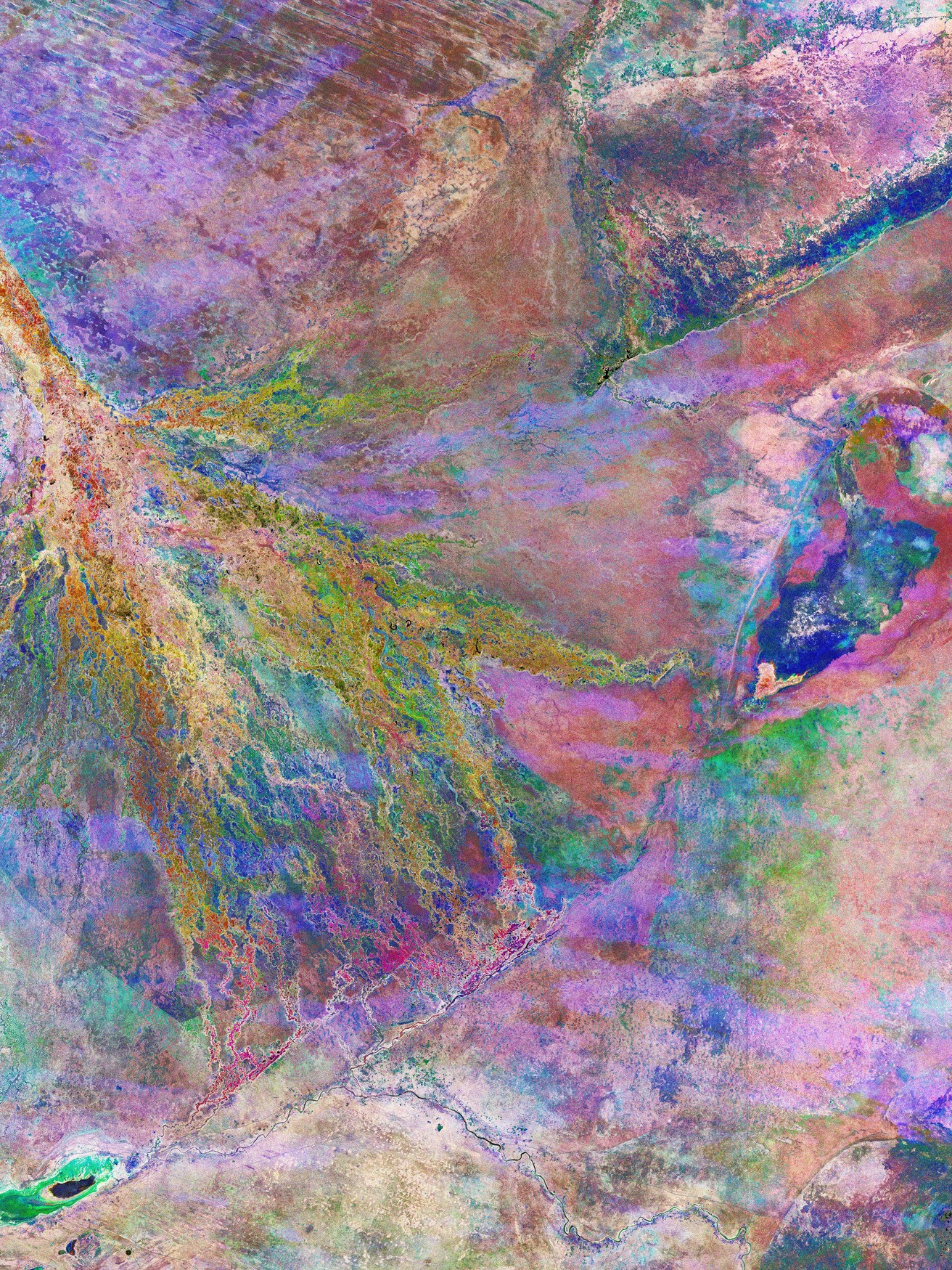
Botswana’s Okavango Delta – one of the world’s largest inland delta – is featured in this multitemporal radar image, captured by the Sentinel-1 satellite in Europe’s vast Copernicus program. The Okavango Delta, a labyrinth of lagoons, swamps, channels and islands, is a UNESCO World Heritage Site and part of the Ramsar wetland network. Because wetlands are difficult to access, satellites are often key information sources. This composite view combines three Sentinel-1 radar images, acquired over eight months in 2021. Each image has a different color – red for January, green for April and blue for August – to show how both land and water change over time.
Radar imagery from satellites also allows scientists to analyze the impact of earthquakes. The Sentinel-1 satellite carries a radar instrument that can “see” through clouds, day or night.
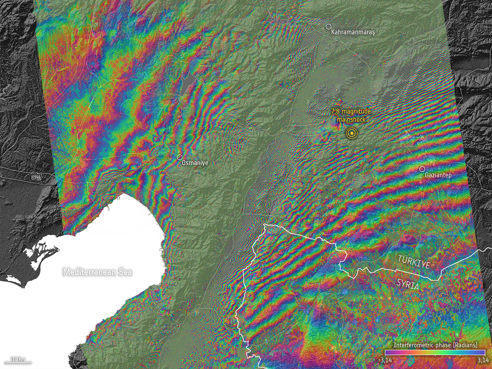
This image shows how the Earth’s surface was deformed by the earthquake that struck Turkey and Syria on February 6, 2023. Each fringe is equivalent to about 5 centimeters (Sentinel-1’s wavelength) and more than 60 fringes can be detected, which means that the two sides of the big Anatolian fault have moved at least three meters in relation to each other. From images like this, geologists have estimated peak displacements up to about 10 meters – making it obvious that even the most robust buildings are unable to support deformation of this magnitude, inevitably resulting in a huge loss of life.
To plan ahead for global warming and protect our planet, we need precise information about how the environment is changing. Earth observation satellites are designed to provide highly accurate global information over long periods of time.
While meteorology was the first scientific discipline to call on spaceborne sensors in the 1960s, satellites now help track our planet’s health by providing a broad range of data, including weather analyses, ocean color and temperature, and even measurements of Earth’s gravity.
Some observation satellites now circling the Earth are purpose-designed for environmental monitoring. Satellites allow scientists and decision-makers to better monitor the impact of climate change, and they are often the only way to monitor parts of the world without ground-based systems.
Satellites stay focused on our planet day after day, not only helping us better understand climate change, but also supporting emergency efforts when nature goes wild, making better use of natural resources and protecting populations at risk.

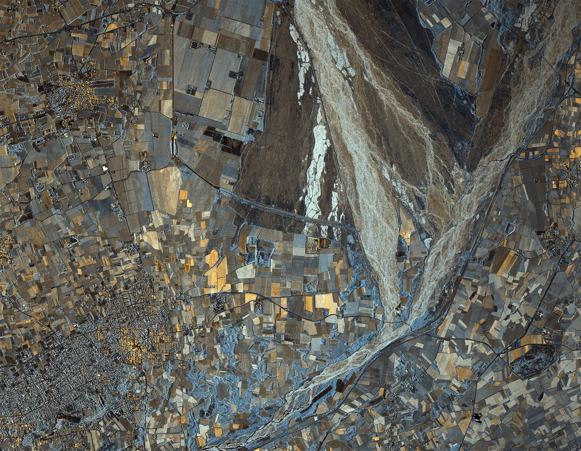
Credit: COSMO-SkyMed Product - ©ASI - Agenzia Spaziale Italiana - 2022. All rights reserved.
Distributed by ASI and processed by e-GEOS
Credit: COSMO-SkyMed Product - ©ASI - Agenzia Spaziale Italiana - 2022. All rights reserved.
Distributed by ASI and processed by e-GEOS
The latest COSMO-SkyMed Second Generation satellite has transmitted its first images, giving stunning close-up looks at regions extending from Antarctica and Italy to the Galapagos Islands.
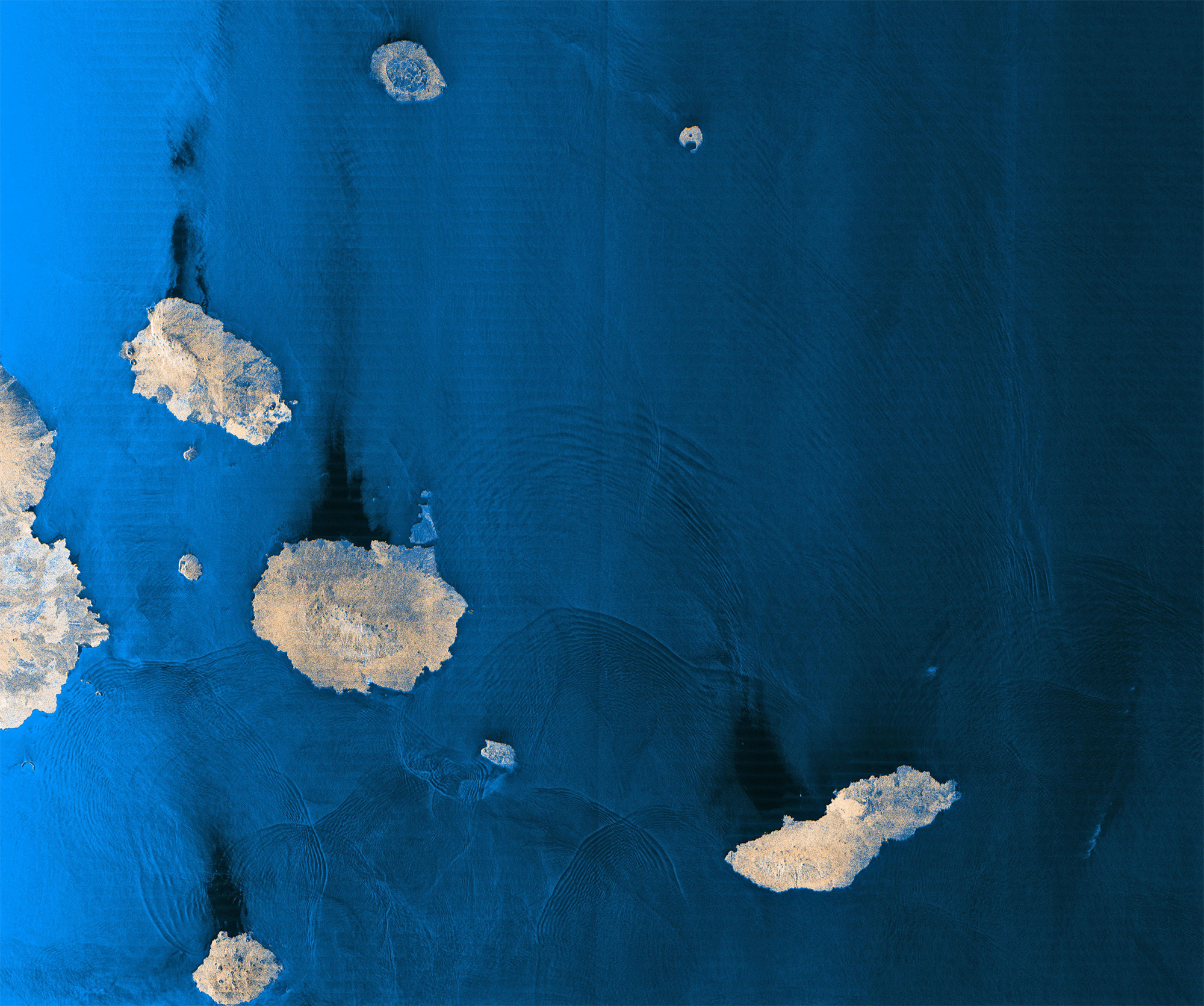
Credit: COSMO-SkyMed Product - ©ASI - Agenzia Spaziale Italiana - 2022. All rights reserved.
Distributed by ASI and processed by e-GEOS
This impressive performance continues to demonstrate the fundamental role played by Italy’s own radar observation satellites to support sustainability across the planet. The COSMO-SkyMed Second Generation constellation is funded by the Italian space agency ASI, with contributions from the Italian ministries of defense and higher education & research.

© Thales Alenia Space
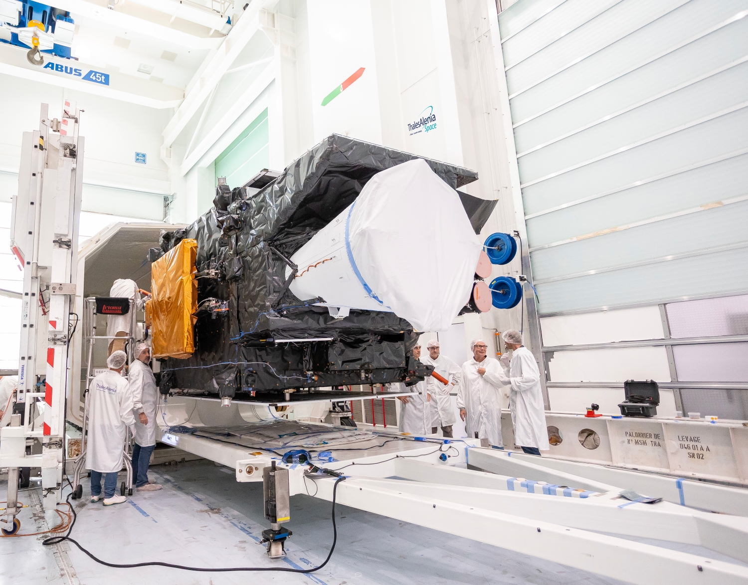
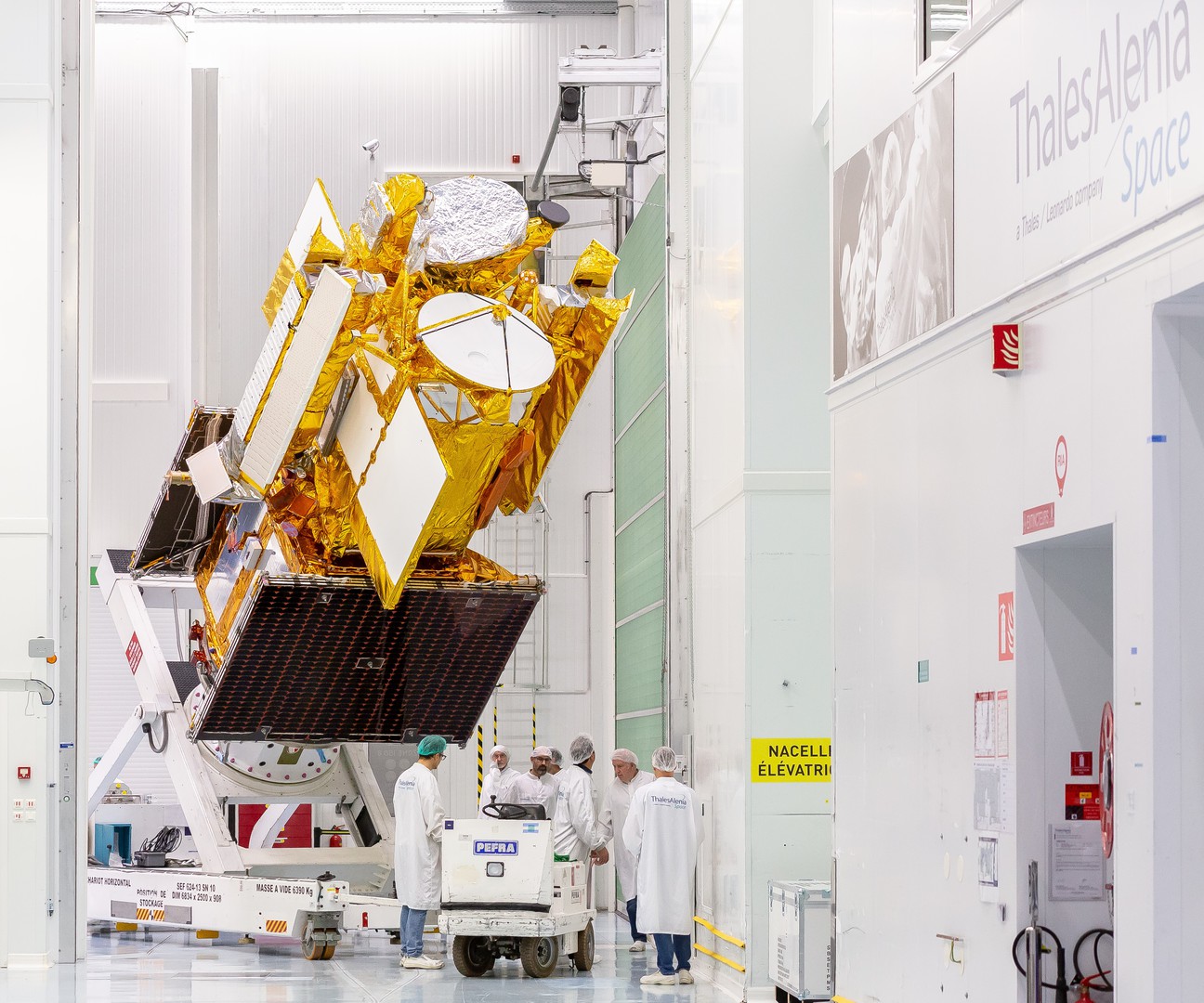
Thales Alenia Space is in charge of the entire COSMO-SkyMed Second Generation program, including satellite design and development, as well as the design, integration and commissioning of the end-to-end system. Telespazio is responsible for the design and development of the ground segment, while also providing integrated logistics and operational services.
Telespazio's Fucino-based Space Center, a joint venture between Leonardo (67%) and Thales (33%), will manage the satellite's launch and early orbit phase (LEOP), as it sends its first telemetry data.
Leonardo supplies attitude control equipment, plus state-of-the-art electrical power management and distribution units.
COSMO-SkyMed data is marketed worldwide by e-GEOS, a joint venture between Telespazio (80%) and ASI (20%) which develops applications and provides operational services.
Revolutionizing meteorology with MTG
First MTG imaging satellite © Thales Alenia Space/Imag[IN]
Over the decades, European meteorology has become increasingly accurate. With the first generation of Meteosat, images were updated every 30 minutes, a rate that dropped to 15 minutes for the second generation. Meteosat Third Generation (MTG), will now update images every ten minutes, making weather forecasts increasingly accurate. Information delivered by MTG promises to revolutionize weather forecasting, while supporting more precise monitoring of our changing atmosphere, land surfaces and oceans. MTG is designed to improve weather forecasts, especially for severe storms, since these storms are an increasing hazard to people everywhere. Over and above weather forecasts, this unique fleet of satellites will deliver huge amounts of date to model the Earth system, better understand climate change and ultimately help us adapt to changing conditions. The MTG constellation comprises six satellites: four imaging and two sounding satellites. The two state-of-the-art atmospheric sounding satellites will provide 3D maps of the atmosphere—a world first – and will be able to detect severe weather events half a day in advance. By combining all these capabilities, meteorologists can accurately forecast the weather up to eight days in advance, giving populations much earlier warning of severe weather events. In addition to saving lives, MTG will pave the way for new services in Europe and Africa. The first third-generation satellite, MTG-I1, was successfully launched on December 13, 2022. Once the entire MTG fleet is in orbit, Eumetsat will offer the best weather services in the world.
Monitoring oceans
SWOT © Thales Alenia Space/Imag[IN]
French and U.S. Oceanographers and hydrologists and international partners have joined forces to develop SWOT, a satellite mission featuring our radar altimeters, to make the first global survey of Earth's surface water, observe the fine details of the ocean's surface topography, and measure how water bodies change over time. A joint mission between CNES and NASA, this satellite, mostly built by Thales Alenia Space in cooperation with the Jet Propulsion Laboratory, is set to revolutionize oceanography and continental hydrology. Successfully launched in December 2022, SWOT features a controlled atmospheric reentry subsystem, which means no debris will be created when it reaches end-of-life.
Earth has a new ally: Iride
Iride © Thales Alenia Space
Iride is Europe’s largest low-altitude Earth observation program, sponsored in part by NextGenerationEU, a vast European Union initiative designed to support the continent’s economic recovery from the coronavirus pandemic and build a greener, more digital future.
The Iride constellation will comprise 36 satellites of different types and sizes, combining SAR, optical, panchromatic, hyperspectral and infrared sensors to provide geospatial services to both government and commercial customers in Europe. Planned for completion by 2026, the constellation will be built in Italy with support from the European and Italian space agencies.
Thales Alenia Space will build six SAR (synthetic aperture radar) satellites and one optical satellite, both types using the modular NIMBUS (New Italian Micro Bus) platform, which is purpose-designed for high-capacity constellations featuring high revisit rates.