Lifting off from Thales's stand at the Singapore Airshow for a trip into space

Lifting off from Thales's stand at the Singapore Airshow for a trip into space
Are you « Space » Experienced ?
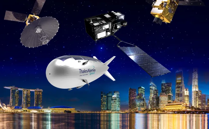
For those of you lucky enough to visit the Thales booth (#F23) at the Singapore Airshow 2018 from February 6 to 11, you are in for a real “Space Experience”. This is a spectacular interactive exhibition, in which visitors can discover the full breadth of Thales Alenia Space’s activities in an immersive manner. The focal point of the Space Experience is undoubtedly the “Immersive Space Journey”, a film designed to show the different stages of a trip into space, taking visitors from Earth to Mars. So don’t miss the “Space Experience” ! More info
Focus on Sentinel-3B

Sentinel-3B is a real “multitasking” operational spacecraft. Its mission encompasses oceanography, continental hydrology and the monitoring of vegetation on land. In particular, the satellite will conduct surface topography, which entails the precise measurement of sea height, wave height and wind speed over oceans. Like its twin, Sentiel-3A, Sentinel-3B will also measure the temperature and color of oceans, lakes and rivers.
Sentinel-3B carries four payloads in an optimized layout: an altimeter connected to a microwave radiometer for surface topography and two instruments that independently measure water surface temperature and color (OLCI). A very-high-resolution multispectral optical instrument, the OLCI is a wide swath (an essential characteristic for operational oceanography) hyperspectral spectro-radiometer. It is designed to monitor the state of oceans (currents, marine life, etc.) and observe coastal zones.
Sentinel-3B is being built by Thales Alenia Space as prime contractor, on behalf of the European Space Agency within the scope of the European Union’s Copernicus program. It will shortly be rolled out of Thales Alenia Space’s Cannes plant for a launch scheduled for mid-April 2018.
A complete range of optical and radar observation systems

Intelligence, maritime surveillance, mapping, crisis management… Spaceborne systems allow users, especially governments, to deploy a number of different surveillance applications to ensure their security and independence. A growing number of countries have expressed an interest in acquiring space systems capable of independently providing high-resolution images for intelligence purposes. Thales Alenia Space draws on over 30 years of experience to offer a complete range of observation systems that meet market expectations, including optical and radar sensors, and ground user segments.

The European satellite manufacturer is actually proposing a comprehensive and flexible satellite solution, based on the high-performance Optical Observation System, and the Radar Observation System, featuring an active synthetic aperture radar (SAR). This solution perfectly addresses users’ need for dual (civil/military) observation systems. It is designed for operational applications such as surveillance, agriculture, urban development and the management of risks and natural disasters.
Stratobus, a new approach to surveillance

StratobusTM, an autonomous multi-mission stratospheric airship, is also being presented at GSTC. Perfectly complementary with satellite systems, it offers the significant advantage of not requiring a launch vehicle. StratobusTM is fully capable of meeting the needs of both defense and security forces, for instance by providing permanent surveillance of a predefined regional coverage zone. More info on Stratobus
Copyrights:
First artistic view & Stratobus: © Thales Alenia Space/Briot
Immersive Space Journey video: © Thales Alenia Space/Master Image Programmes
Sentinel-3B: © ESA/Pierre Carril
Optical & Radar Earth Observation solutions: © Thales Alenia Space/Master Image Programmes

