Satellites for a better Life on Earth
Putting our expertise and passion to the service of sustainable missions.
Satellites for a better Life on Earth
Putting our expertise and passion to the service of sustainable missions.
In Space, governments, institutions and companies rely on our company to design, deliver and operate satellite-based systems that help them position and connect anyone or anything, everywhere, observe our planet, protect and defend, explore our solar system. Thales Alenia Space believes in space as humankind’s new horizon to build a more sustainable life on Earth. Space for Life perfectly emphasizes our vision covering all the five markets in which we operate in space. In the current context and pandemic situation, this vision is more than ever appropriate, in particular considering the growing focus from institutions on Green deals, notably in Europe. Our Earth observation, navigation and telecom space-based activities, that represent 75% of our portfolio, are strongly contributing to sustainability.
Space to Observe & Protect
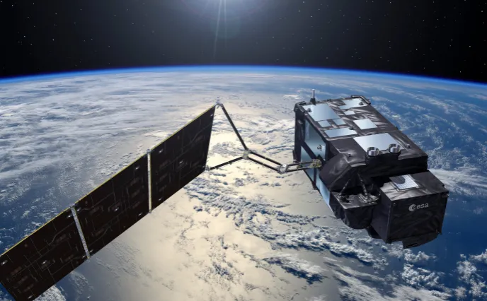
Sentinel benevolent satellites
In the field of Earth Observation, let’s have a look on the stunning missions being performed thanks to European program, Copernicus. The Sentinel family of satellites, developed on behalf of the European Space Agency (ESA) within the scope of the European Commission’s Copernicus program, spearheads Europe’s environmental monitoring efforts. Sentinel-1 monitors land and sea in all-weather conditions, day or night thanks to its radar capabilities ; Sentinel-2 and -3 acquires optical imagery at high resolution over land and coastal waters ; the Sentinel-4 and -5 are dedicated to meteorology and climatology missions; and Sentinel-6 monitors the global ocean. Thales Alenia Space is prime for Sentinel-1 and -3 (4 satellites for each mission), in charge of the Sentinel-2 image ground segment, contributes to the imager-spectrometer on Sentinel-5P and the Poseidon-4 radar altimeter for Sentinel-6.
Thales Alenia Space was also chosen for five of the six new Copernicus Expansion missions, three as prime - CIMR, ROSE-L and CHIME - and will supply payloads for two other missions - CO2M and CRISTAL. These new satellites will be used to measure carbon dioxide emissions in the atmosphere from human activity, check the thickness of ice fields and the snow covering it, support advanced new services for the sustainable management of agriculture and biodiversity, observe the temperature and salinity of sea surfaces, as well as the density of ice fields, and bolster land monitoring and emergency management services. Our company works hand in hand with the European Space Agency, and the European industrial space ecosystem, being onboard 11 out of 12 Copernicus missions.
Along with these ambitious programs, our engineers are also working on MicroCarb, the first European mission designed to characterize greenhouse gas flows on the Earth’s surface and measure the amount of carbon absorbed by oceans and forests.
A more and more accurate meteorology
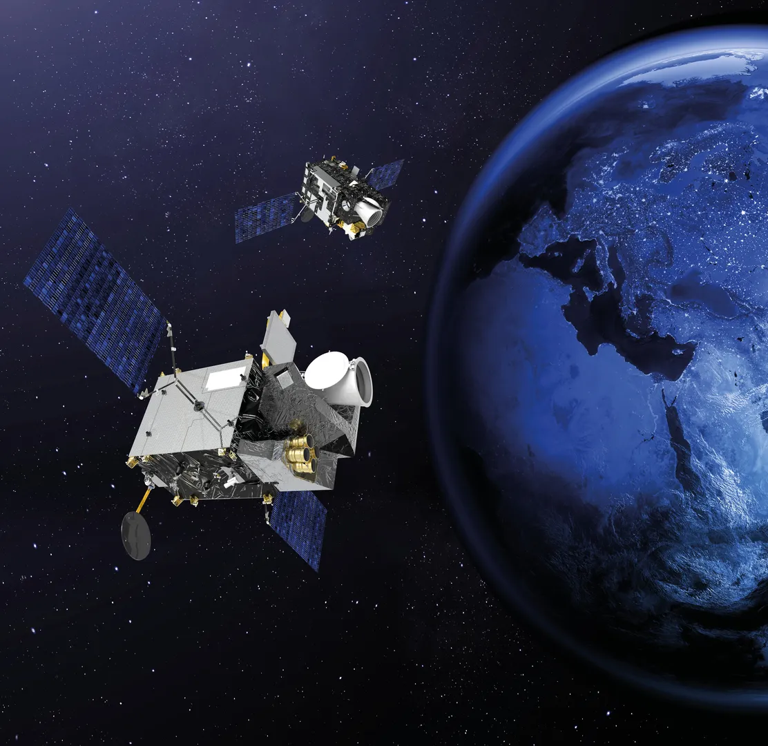
Meteorologists have called on the rich data harvest from Meteosat satellites for over 45 years to make their weather forecasts. Thales Alenia Space has built all geostationary European meteorological satellites as prime. With the upcoming MTG (Meteosat Third Generation), images will be updated every ten minutes and these satellites will also carry atmospheric sounders, making weather forecasts even more reliable. MTG includes 6 satellites: 4 imaging and 2 atmospheric sounding ones. The two atmospheric sounding satellites will be making a real technological leap to yield 3D maps of the atmosphere—a world first. The sounders will enable detection of severe weather events half a day ahead. And by combining the whole system, forecasters will be able to do their job better and forecast eight days ahead. That will be a big step forward in giving populations early warning of major events. MTG really is going to help save lives while paving the way for new kinds of services for Europe’s and Africa’s citizens. Once the entire MTG fleet is in orbit, Eumetsat will have the best weather services in the world.
Understanding oceans
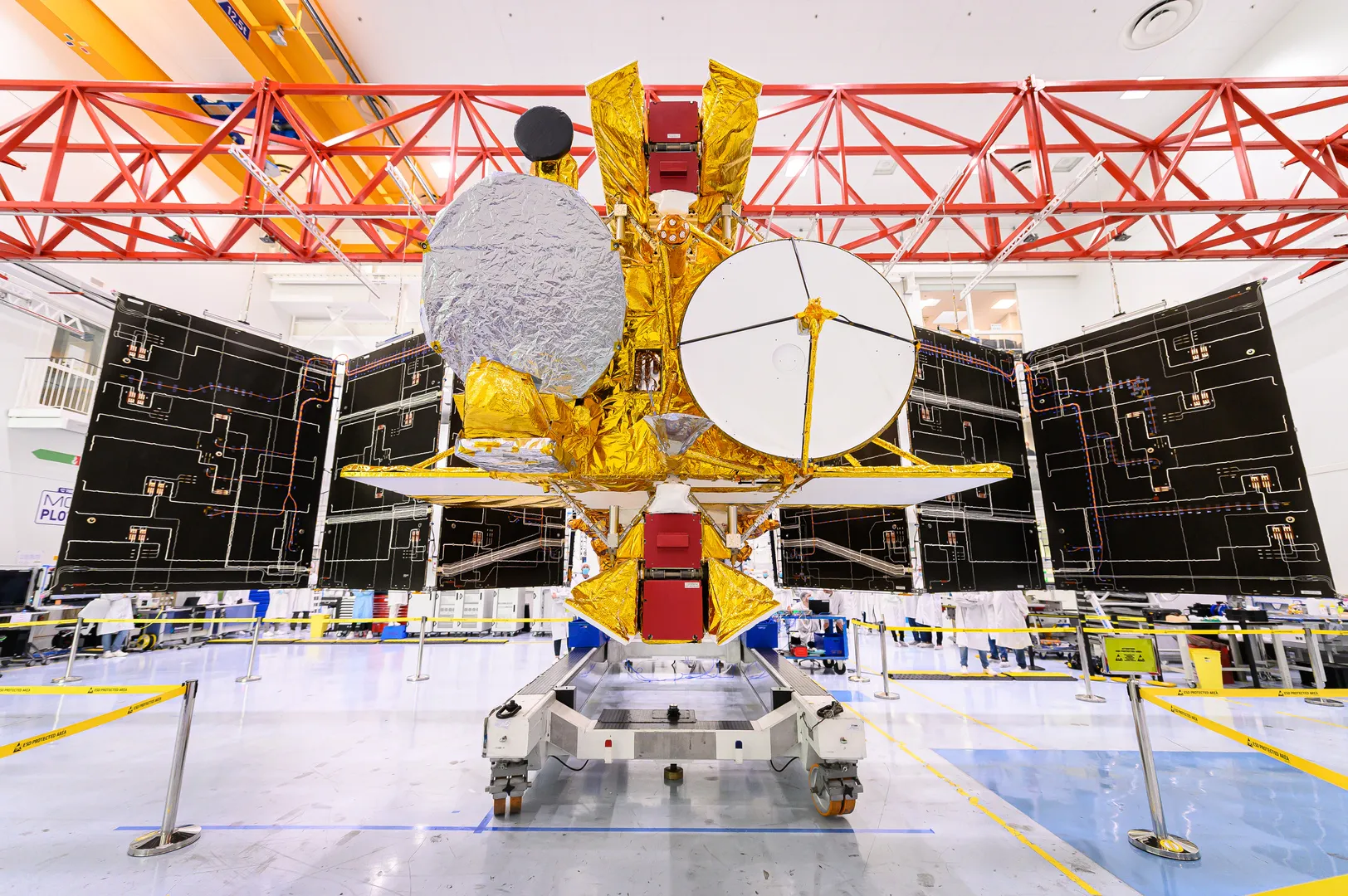
Our employees are particularly proud of providing the space-based altimetry, an advanced altitude measurement technology that is used to study sea surfaces, the thickness of sea ice and lake and river levels. It can also be used to determine land, ice cap and seabed topography. We have supplied the radar altimeters for a number of international missions. In addition, French-American oceanography satellite SWOT will revolutionize modern oceanography. Built on behalf of NASA and CNES, SWOT will be fitted by design with a controlled atmospheric reentry subsystem avoiding any debris generation at end-of-life.
Space to Travel & Navigate
Space systems for solutions down on Earth

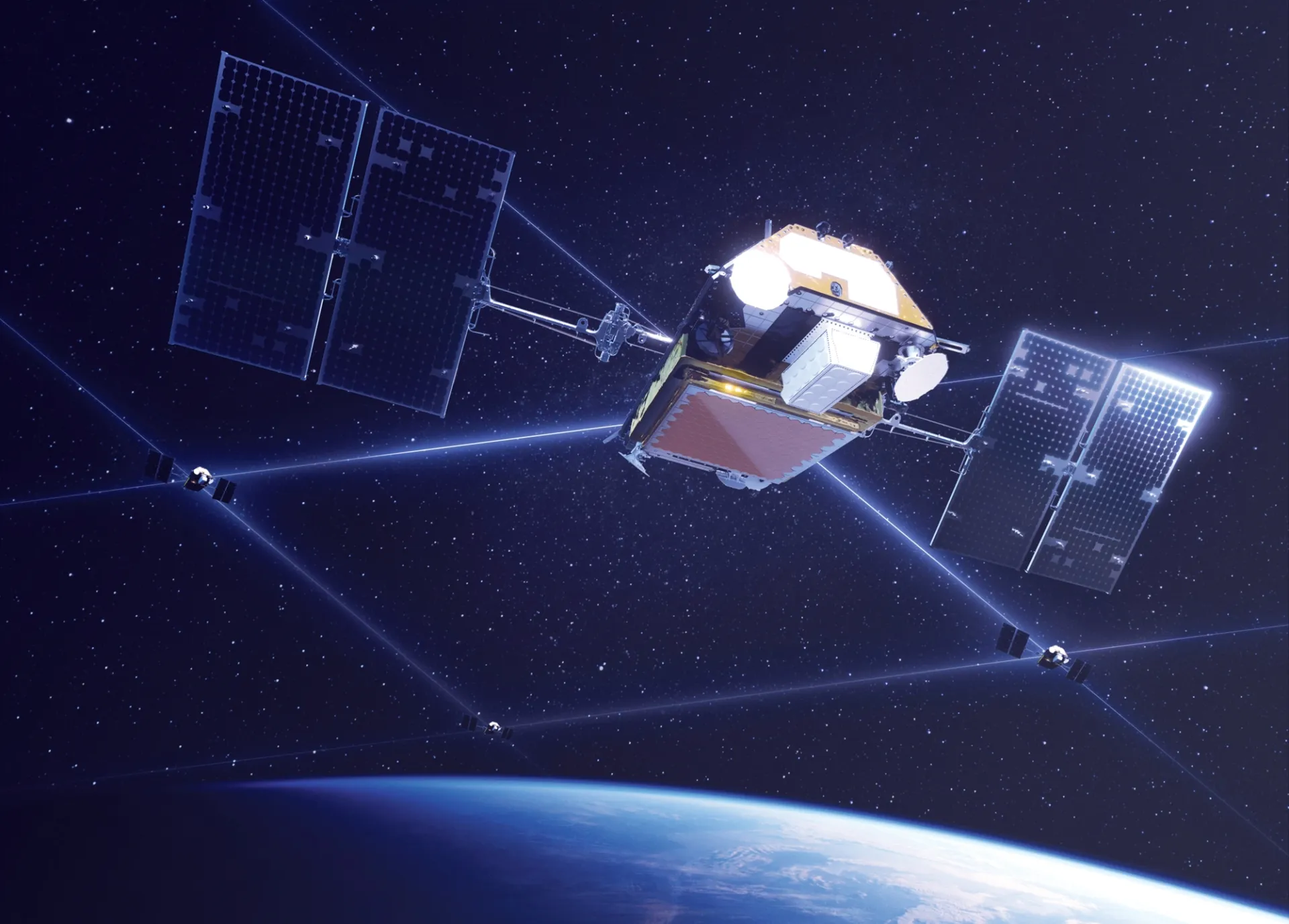
Farming was one of the first business sectors to adopt satellite technology. Today, for instance, over 90% of all tractors in the European Union benefit from EGNOS services, which enhance satellite positioning systems, allowing farmers to save fuel by making sure they don’t pass several times over the same parcels, and also reduce by 20% the use of pesticides and fertilizer via more specifically targeted applications. But agriculture is just one of the many sectors using space systems to become more eco-conscious. Europe’s own satellite navigation system, Galileo, also helps reduce the environmental impact of road traffic, since satellite navigation helps reduce traffic jams to decrease the overall carbon footprint. Likewise, car-pooling and other sustainable mobility applications all depend on precision geolocation. Europe’s Global Navigation Satellite System (GNSS) services, especially EGNOS, help make air travel more environmentally-friendly and accessible. Airport procedures calling on EGNOS result in fewer aborted landings, thus reducing fuel consumption for airlines and carbon emissions in general. Thales Alenia Space will play a pivotal role in the Galileo Second Generation system by boosting the constellation’s performance and cybersecurity. ESA and the European Commission have chosen Thales Alenia Space to 6 new satellites out of 12 for Galileo Second Generation.
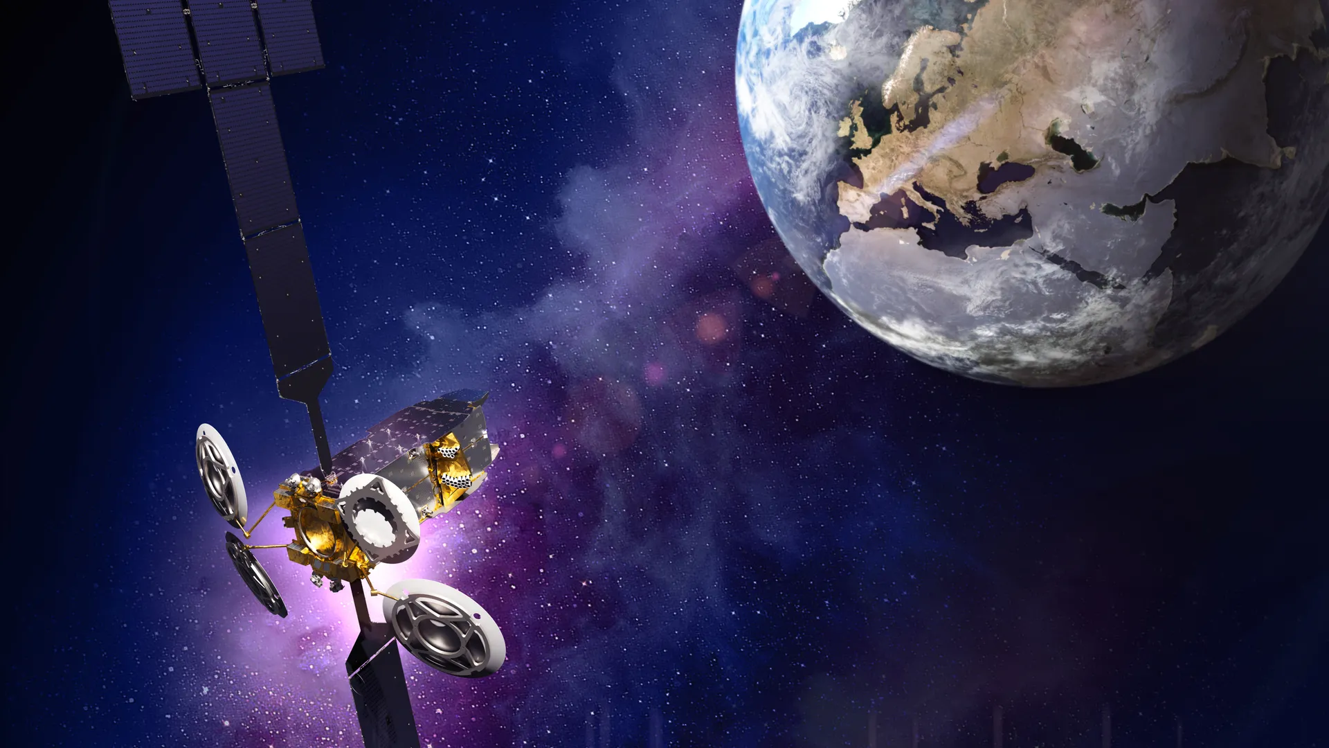
Space to connect
Based on latest estimates from the International Telecommunication Union, 5 billion inhabitants live more than 10 km away from any fiber optic cable infrastructure. Covid-19 pandemic dramatically increased the importance of internet communications infrastructure. Satcom constellations and geostationary telecommunications satellites complement terrestrial infrastructure, providing connectivity to people living in remote areas and bridging the digital divide all over the world.
Our company built 3 telecommunications satellite constellations under its prime contractorship: Globalstar 2, O3B and Iridium NEXT. Including 66 operational satellites in orbit, Iridium NEXT, for instance, offers currently unmatched capacity for truly global mobile communications – serving people, vehicles, planes and boats. Renowned for its robustness and sophistication, this complex system is the only one of its kind able to operate over the seas and oceans that make up 70% of the Earth’s surface, as well as polar areas. Satellite crosslinks mean that the constellation operates independently of ground infrastructures, providing more secure telecommunications and protection against intruders and spoofing. The constellation can also help maintain vital telecommunications services in the wake of natural disasters like typhoons, hurricanes and tsunamis.
Bridging the digital divide across Europe
The digital divide still largely affects Europe, as illustrated very clearly by the numbers: only 27%of European households have Internet access at speeds greater than 30 Mbps. In isolated zones, often rural, with only inadequate service, or none at all, building out a fiber-optic network could prove to be very expensive in relation to the number of connections. The EUTELSAT KONNECT VHTS satellite features a high-performance 5th generation digital transparent processor, to offer an instantaneous data rate across Europe of about 500 Gbps, including about 60 Gbps in mainland France. This means that it will meet the needs of some hundred thousand isolated households scattered across the country. Successfully launched in 2022, EUTELSAT KONNECT VHTS will play a major role in giving everybody in Europe access to the power of digital.
Bridging the digital divide worldwide

In line with EUTELSAT KONNECT, launched in 2020, and EUTELSAT KONNECT VHTS, with coverage zones over Africa and Europe, Thales Alenia Space has always been a leading manufacturer of satellites and payloads designed to reduce the digital divide worldwide. Two examples of our contributions in Asia: The Bangladeshi satellite Bangabandhu Satellite-1 launched in 2018 offers a wide array of telecom services to everybody in the country, including direct-to-home TV, radio, telemedicine, distance learning and internet access. It spurs the country’s economic growth and enables solutions for a number of business sectors, including defense, medicine, education, research, videoconferencing and much more.
The Indonesian satellite SATRIA is also designed to reduce the digital divide. It aims to connect some 145,000 different zones, encompassing 90,000 schools, 40,000 hospitals and other public buildings, along with regional government facilities not already connected by existing networks. This very-high-throughput geostationary communications satellite will boost the development of digital infrastructures in Indonesia.
Space to Explore

Mercury, Venus, the Moon, Mars, Saturn, Jupiter, asteroid and comets. Thales Alenia Space has always been a pivotal industrial player onboard the most fantastic space exploration missions. The company is also a key industrial actor in the field of sciences, with iconic programs such as Euclid, made to study dark matter and dark energy. The world leader in orbital infrastructures, the company provided half of the ISS’ pressurized volume, where thousands of space experiments were handled directly in orbit in the fields of medicine, microbiology, chemistry, nanotechnologies and many more. All these experiments performed under 0 gravity will be reused in the years to come to improve citizens’ quality of life on Earth.
Thales Alenia Space also built cargo modules dedicated to former ATVs and Cygnus cargo vessels. These spacecraft are meant to provide food, water, fuel, supplies, repairs, space experiment to the different crews onboard the ISS. Leveraging on this on-of-kind technological legacy, Thales Alenia Space was chosen to build 3 pressurized modules dedicated to Lunar Gateway and 2 ones for Axiom commercial space station. Axiom Space will also contribute to extending the boundaries of research and science activities in space for a more sustainable life on Earth. As a key partner onboard NASA’s Orionmanned spacecraft, Thales Alenia Space will definitely contribute to the exploration of the Moon and Mars. These kind of missions contribute to better understanding the origins of our solar system, pushing the boundaries of knowledge to the benefit of scientific research.